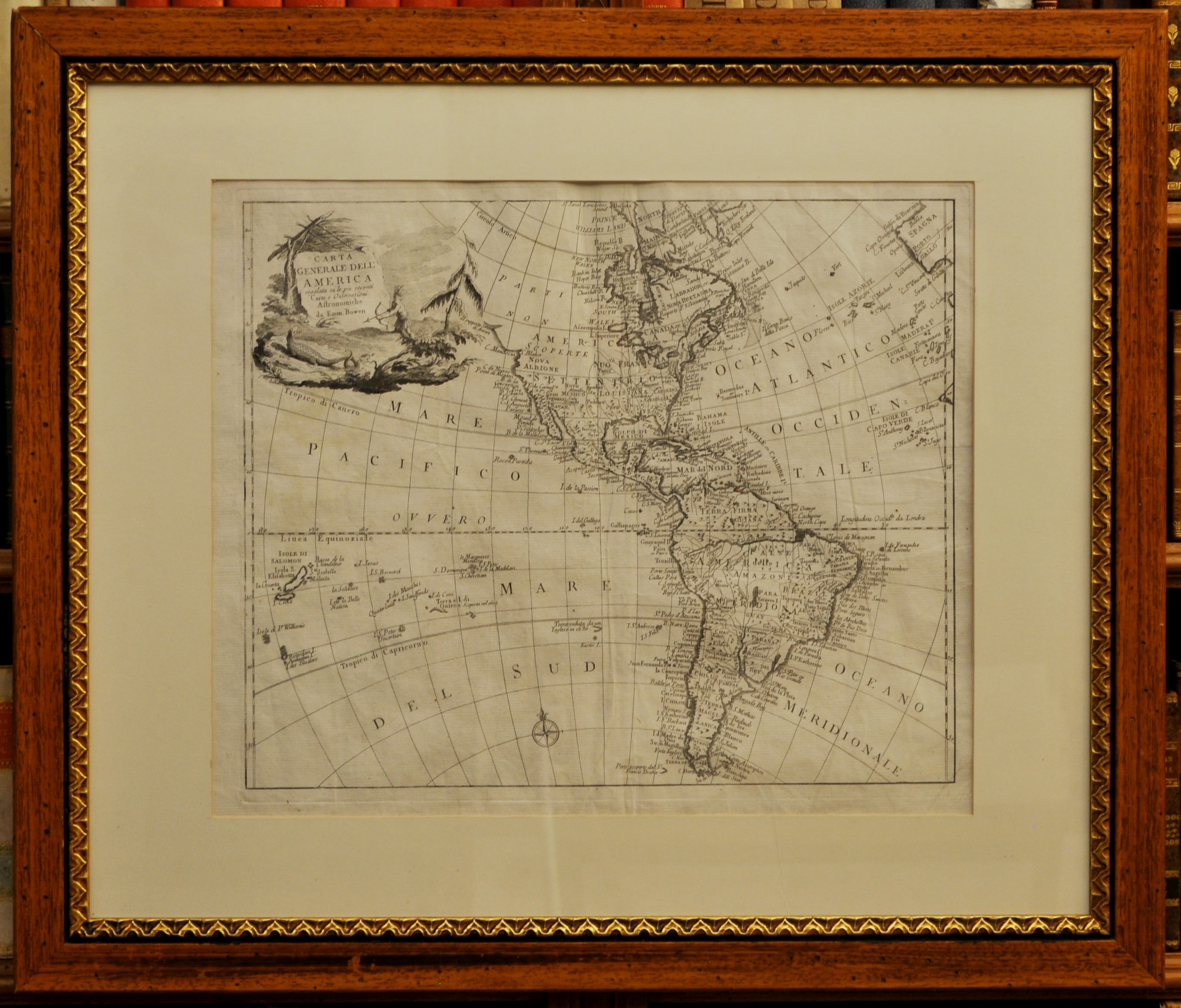
350 x 430. Vergata grossa. Filigrana non rilevata. Foglio ad ampi margini. Lieve strappo sul margine bianco sinistro. Bellissimo esemplare. Carta Generale dell’America regolata sulle più recenti carte e osservazioni astronomiche da Emm. Bowen. Toponimi. Proveniente da “Storia degli stabilimenti europei in America divisa in sei parti nelle quali oltre una breve notizia della scoperta, e conquiste fatte in quella parte di mondo de’ costumi, e maniere de’ popoli originarj, si da un’esatta descrizione delle cola stabilite colonie … Tradotta in italiano dalla seconda edizione inglese. Volume primo -secondo”. Traduzione italiana di “An account of the European settlements in America” London 1747, opera attribuita a Edmund e William Burke. Emanuel Bowen, map and print seller, engraver to George II and to Louis XV of France worked in London from 1714 producing some the best and most attractive maps of the 18th century. He had plans for completing a major County Atlas but, finding the task beyond his means, joined with Thomas Kitchin to publish “The Large English Atlas”. Many of the maps were issued individually from 1749 onwards and the whole atlas was not finally completed until 1760. With one or two exceptions they were the largest maps of the counties to appear up to that time (27″ x 20″) and were unusual in that blank areas around each map are filled with historical and topographical detail which makes fascinating and amusing reading. The atlas was reissued later in reduced size. Apart from his county maps and atlases of different parts of the world he also issued (with John Owen) a book of road maps based, as was usual at that time, on Ogilby but again incorporating his own style of historical and heraldic detail. Thomas helped his father during his lifetime and produced many fine maps in his own right after his fathers death.
Libreria Emiliana
Antiquaria
Libri e Stampe Veneziane
dal XV al XXI Secolo
dal XV al XXI Secolo


